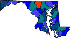
Carroll County was created from parts of Baltimore and Frederick counties with its first settlers including German decent. The County was named for Charles Carroll of Carrollton, a revolutionary war statesman and a Maryland signer of Declaration of Independence.
Westminster is the largest town in Carroll County. Full of history from the Civil War where troops traveled to Gettysburg. The Carroll County Farm Museum that provided work and shelter for indigent men and women which stayed in operation until 1965. The Maryland Wine Festival is held yearly at the Carroll County Farm Museum. The Union Mill Homestead is the family home of the Shrivers for six generations. The Pennsylvania Dutch Farmers Market of Westminster is held year round.
|
| Size: 452 Square Miles |
| County Seat: Westminster |
| Government Form: County Commissioners |
| Population 2000: 150,897 |
| Median income for a household (2000): $60,021 |
| Median income for a family (2000): $66,430 |
|
|


