
| The county was named for Lady Anne Arundell, the daughter of Thomas Arundell, 1st Baron Arundell of Wardour, members of the ancient family of Arundells in Cornwall, England, and the wife of Cecilius Calvert, 2nd Lord Baltimore. Home of Baltimore-Washington International Thurgood Marshall Airport (BWI), called America's Sailing Capital, best for the Chesapeake Bay, the U.S. Naval Academy, maryland blue crabs and crab cakes, with over 500 miles of shoreline and historic Chesapeake Bay light houses and Arundel Mills, one of the largest malls in the country. |
| Size: 588 Square Miles |
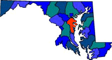
| County Seat: Annapolis |
| Government Form: Charter since 1964 |
| Population 2000: 489,656 |
| Median income for a household (2000): $61,768 |
| Median income for a family (2000): $39,886 |
|
| West Anne Arundel Chamber of Commerce |
| Northern Anne Arundel Chamber of Commerce |
| Anne Arundel County / Annapolis Area Guide |
| Southern Anne Arundel Chamber of Commerce |
| Anne Arundel Economic Development Corporation |
| Anne Arundel Community College |
| Anne Arundel County |
| Anne Arundel County Health Department |
| Anne Arundel Public Schools |
| Advertising Rates | Disclaimer | Site Map |
| Delmarweb, (Maryland) Copyright © 1997 - 2012 All Rights Reserved |