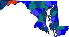


| Allegany County is in the western portion of Maryland. Allegany County was formed in 1789 from Washington County. Allegany comes from the Native American word oolikhanna, meaning "beautiful stream." There are three state parks; Dan's Mountain State Park, Green Ridge State Forest and Rocky Gap State Park. Rocky Gap State Park (exit 50 off I-68) is great for trails and views of Lake Habeeb. The lake has swimming beaches, boat ramps, as wells as rentals for boats, canoes, paddle boats and kayaks. The park has camping sites. Green Ridge State Forest (exit 64 off I-68) has lots of wildlife and views with biking and backpacking trails. Good for off-road driving, canoeing, kayaking, fishing and hunting. Dan's Mountain State Park (9 miles south of Frostburg) is the smallest in Western Maryland. The Olympic-size pool with water slide attract families with kids. |
| Size: 557 Square Miles |
| County Seat: Cumberland |
| Government Form: Since 1974 Code Home Rule |
| Population 2000: 74,930 |
| Median income for a household (2000): $30,821 |
| Median income for a family (2000): $39,886 |
|
| Allegany County Chamber of Commerce |
| The Mountainside of Maryland |
| Allegany College of Maryland |
| Frostburg State University |
| Allegany County Government |
| Allegany Arts Council |
| Allegany County Public Schools |
| Allegany County Health Department |
| Allegany County Library System |
| Advertising Rates | Disclaimer | Site Map |
| Delmarweb, (Maryland) Copyright © 1997 - 2012 All Rights Reserved |